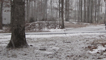
It is just before 1pm on Saturday December 19th and the snow is just starting to fall. Even now the snow seems to be falling with a lot more intensity then it normally does. This isn’t a “slow” snowfall, it is definitely falling with a purpose. Ever since the cold front came in earlier this week the ground has been frozen solid which means that any snow that falls is definitely going to12″ stick and accumulate.
Right now the “Winter Storm Warning” projections are still at 4-8 inches of snow for the Poconos. The weather “prediction” maps are showing us well within the 6-12 inch range with Philadelphia in the 12+ inch range.
Last night there was the rush and bustle associated not only with getting ready for a big storm, but also for trying to get some last minute Christmas shopping in before the snow hits. Although this storm has the potential to drop a lot of snow in the Poconos, we have gotten ‘punked’ in the past and only ended up with a few inches. But if the start of this storm is any indicator of what is expected to come, then it looks like it’s shaping up to be more then just a normal storm.
If you have to go out today or tomorrow morning just be cautious, the wind is going to make it more difficult to see then usual and the roads can be dangerous until they get plowed. If you are off the main roads be especially cautious – do not pull over on the side of the road unless you need to – if you need to stop be sure to pull into a parking lot, driveway, etc. There are many areas that have drainage ditches/holes that are bound to be covered in snow and you definitely do not want to get stuck in them.
Leave a Reply